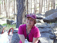


Lemhi Pass
Journal Day 5
7/29/04
Butte to Missoula; Lemhi pass
59 degrees at 9am in Butte, MT. We are glad we have the heater.
Another plan change. Today we go to Lemhi Pass, then maybe Lolo; then camp in Missoula, MT.
We just passed Beaverhead Rock. It was a landmark that Sacagawea recognized, telling Lcwis and Clark that her tribe, the Shoshone, would be camped in the area. Distant high mountain ranges surround us. The Bitteroot Mts. are off in the distance to the right. Next we see the Clark Canyon Reservoir. This is the site of Camp Fortunate, where part of the Corps and the Shoshones meet and camp together on 8/17/1805. Soon Sacajawea will arrive with the rest of the Corps and discover that the Shoshone chief, Cameahwait, is her long-lost brother.
We decide to park the trailer and go up Lemhi pass, even though we have only 1/4 tank of gas. On the way up I saw 2 prairie dogs, the 1st I've seen. We see a lot of hawks.
8/12/1805--this is where Meriwether Lewis was the 1st white man to cross the Continental Divide. He looked west and saw the Bitteroot Mts., and knew there was no easy portage to the Columbia river, and no Northwest Passage.
There we stood, elevation 7506'. We stood where Lewis stood. Garrett took pictures of the range. I had a Lewis and Clark historical/spiritual experience; gazing off at the Bitteroot Mts. just like Lewis. We turned to go back to the truck. The left rear tire was flat.
This enabled us to experience emotions similar to what Lewis may have felt standing in this same spot, as he realized the Rocky Mts. were nothing like the Blue Ridge or Appalachians, and that there WAS no northwest passage.
Fortunately, Garrett changed the tire quickly, while I take pictures of wildflowers to ID later. (I can't draw like Lewis.)
Remember, however, our fuel is low; although Garrett has put in 5 extra gallons of gas that we were carrying. We are quite a few miles from the nearest town. No cell phone service. This just adds more excitement to the story.
So back down the Lemhi Pass road we go. We see a magpie. It's a beautiful drive north along the Lemhi River in Idaho. We make it to Salmon, ID for gas & supplies; we don't run out of gas. All is well. The natives are very friendly & helpful, although gas is 2.06/gal. Unfortunately the sheriff is not as helpful! We'll leave it at that.
Great wildlife viewing along the Salmon River; Great Blue Herons, 2 black tail deer-a buck and a doe-as we come down from Lost Trail Pass. We proceed on, following I93 north to Missoula toward Lolo Hwy 12. We are still on the Lewis & Clark trail--along the Bitteroot River. It doesn't get dark until after 10pm. We make a late camp in Missoula, grateful we have survived the discoveries and Kalamities of the day.
7/29/04
Butte to Missoula; Lemhi pass
59 degrees at 9am in Butte, MT. We are glad we have the heater.
Another plan change. Today we go to Lemhi Pass, then maybe Lolo; then camp in Missoula, MT.
We just passed Beaverhead Rock. It was a landmark that Sacagawea recognized, telling Lcwis and Clark that her tribe, the Shoshone, would be camped in the area. Distant high mountain ranges surround us. The Bitteroot Mts. are off in the distance to the right. Next we see the Clark Canyon Reservoir. This is the site of Camp Fortunate, where part of the Corps and the Shoshones meet and camp together on 8/17/1805. Soon Sacajawea will arrive with the rest of the Corps and discover that the Shoshone chief, Cameahwait, is her long-lost brother.
We decide to park the trailer and go up Lemhi pass, even though we have only 1/4 tank of gas. On the way up I saw 2 prairie dogs, the 1st I've seen. We see a lot of hawks.
8/12/1805--this is where Meriwether Lewis was the 1st white man to cross the Continental Divide. He looked west and saw the Bitteroot Mts., and knew there was no easy portage to the Columbia river, and no Northwest Passage.
There we stood, elevation 7506'. We stood where Lewis stood. Garrett took pictures of the range. I had a Lewis and Clark historical/spiritual experience; gazing off at the Bitteroot Mts. just like Lewis. We turned to go back to the truck. The left rear tire was flat.
This enabled us to experience emotions similar to what Lewis may have felt standing in this same spot, as he realized the Rocky Mts. were nothing like the Blue Ridge or Appalachians, and that there WAS no northwest passage.
Fortunately, Garrett changed the tire quickly, while I take pictures of wildflowers to ID later. (I can't draw like Lewis.)
Remember, however, our fuel is low; although Garrett has put in 5 extra gallons of gas that we were carrying. We are quite a few miles from the nearest town. No cell phone service. This just adds more excitement to the story.
So back down the Lemhi Pass road we go. We see a magpie. It's a beautiful drive north along the Lemhi River in Idaho. We make it to Salmon, ID for gas & supplies; we don't run out of gas. All is well. The natives are very friendly & helpful, although gas is 2.06/gal. Unfortunately the sheriff is not as helpful! We'll leave it at that.
Great wildlife viewing along the Salmon River; Great Blue Herons, 2 black tail deer-a buck and a doe-as we come down from Lost Trail Pass. We proceed on, following I93 north to Missoula toward Lolo Hwy 12. We are still on the Lewis & Clark trail--along the Bitteroot River. It doesn't get dark until after 10pm. We make a late camp in Missoula, grateful we have survived the discoveries and Kalamities of the day.
posted by carol1211k | 12:49 PM

<< Home